Seizing the moment
How data from EUMETSAT’s programmes support meteorologists at Met Éireann to nowcast severe weather events and issue warnings
Credit: European Union Copernicus Sentinel-3

Credit: European Union Copernicus Sentinel-3
Key points:
- Data from EUMETSAT programmes support specialists at Met Éireann in tracking the development and evolution of storms
- Nowcasting approaches using near-real-time satellite data can give forecasters greater confidence when issuing short-notice weather warnings
- EUMETSAT’s next-generation satellite programmes will provide data benefitting flood protection, climate science, and air pollution monitoring
In January 2024, Storm Isha battered Ireland and the UK with wind gusts of almost 150km an hour, driven by a strong jet stream and sharp temperature contrasts over North America.
14 October 2024
02 October 2024
Storm Isha left hundreds of thousands of people without power, ripped trees from the ground, and caused widespread disruption to transport networks.
To anticipate Isha’s development over the Atlantic in the days leading up to the storm, forecasters at Met Éireann in Dublin, Ireland, turned to numerical weather prediction models, which are underpinned by satellite data from EUMETSAT’s Metop and Meteosat programmes.
However, as Isha approached Ireland’s coast, the hard work was just beginning for specialists in the forecast centre who tracked the storm’s every move in near real-time.
“By comparing near-real-time satellite and radar images to the model predictions, we could make any necessary adjustments to the forecast," says Linda Hughes, a forecaster at Met Éireann who was on shift as Isha swept over the country.
“Forecasters were particularly concerned for communities on Ireland’s west coast and upgraded wind warnings for Galway, Donegal, and Mayo counties from orange to red.
“Numerical weather prediction models have vastly improved the accuracy of weather forecasts over the past decade. However, because of the multitude of factors involved in these predictions – which include hundreds of calculations of parameters such as wind speeds, humidity, temperature, and air pressure – they also have some limitations.

Credit: Met Éireann

Credit: Beta Bajgart
“That’s where short-term forecasting approaches, called nowcasting, come in. Satellite and radar data played a critical role in helping our forecast team assess the situation, identify the position of the storm as it developed, and track it across its lifetime.”
Nowcasting also enables teams to have confidence in their decisions.
“Weather warnings save lives; however, they are also disruptive,” says Hughes. “A red code warning may mean roads are closed, emergency services put on alert, and people told to stay indoors. Therefore, we only issue them when necessary.
“Forecasters need to decide under pressure which warnings to issue and when – and then provide briefings on how we think the weather is going to impact people. Satellite data play a crucial role in supporting these decisions. On days when thunderstorms are predicted, we are eagerly watching the satellite images come in.”
Credit: CSU/CIRA & EUMETSAT
Getting the basics right
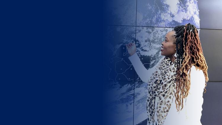
Hughes is a general forecaster, having previously worked as a specialist in aviation safety, marine forecasts, and shipping routes – all of which she says will benefit from new and enhanced data products that will come from EUMETSAT’s next-generation satellite missions.
“Meteosat Third Generation provides the first space-based lightning imaging over Europe, which will be invaluable for pinpointing the early signs of severe thunderstorms and tracking a storm’s movement and intensity,” she says.
“In Ireland, we issue thunderstorm warnings if there is frequent or long-lived activity over a region. To have this additional imagery from space will be brilliant.
“On the other hand, higher-resolution data from new Meteosat and Metop programmes will enable forecasters to identify and predict smaller-scale features that can be tricky to identify, such as fog, turbulence, freak waves, adverse currents, ice, and other hazards.
“This will be useful not only in shipping and aviation, but a wide range of areas that rely on forecasts, including for flood protection, policy making, climate science, and air pollution monitoring.
“No matter what we are forecasting, we need to get the basics right. So, it’s very exciting to see these new observations, satellite technologies and product innovations, and think about the benefits they are going to have for our work.”

Image courtesy of Linda Hughes
A typical week involves shifts in the forecast centre, television and radio appearances, and public outreach at community centres and schools, says Hughes, who also sings in Met Éireann’s choir, the Isobars, which specialises in weather-themed songs.
She adds that while Ireland’s famously changeable weather can provide an “adrenaline rush”, nothing quite beats the moment when the storm has passed.
“Shifts can be so varied, even over the course of a single event, and you need to prepare yourself for each type of day.
“Whether it’s making sense of the early forecast information, taking decisions, or issuing warnings, it’s a great feeling knowing that our work helps reduce the impacts of severe weather on people’s lives, jobs, and properties.
“There is a great team spirit at Met Éireann. In the end you just go into work and try to do your best, and when the weather is calmer, have some fun along the way.”
Author:
Adam Gristwood
Main image
European Union Copernicus Sentinel-3