16 February 2023
28 March 2022
The study followed on from a preliminary study, completed in 2019, on developing a tool to derive per pixel level-1 uncertainties and to implement Level-1/0 monitoring at EUMETSAT. The most recent study, completed in 2021, focused on documenting the calibration methodologies and protocols needed for maintaining operational product quality; an update to the uncertainty tool to include in-orbit parameters; an update to the L0/1 monitoring, and to document methodologies of lunar calibration processing.
Objectives
The main objectives of the study were to:
- Have the ability to quickly react directly to instrument issues that have a direct impact on level-2 products and processing updates.
- Build knowledge and capability on medium to longer-term calibration activities to ensure long-term climate quality calibration capability.
Specifically, the project provided:
- Validation and verification of SLSTR dynamic range and noise characteristics.
- Verification of SLSTR thermal stability.
- Improvements to L1 uncertainty estimation methodologies and associated Python tool (MapnoiS3).
- Improvements to L0/L1 monitoring software.
An additional task was to define an off-line processing algorithm to generate Lunar images from SLSTR level-0 data.
Overview
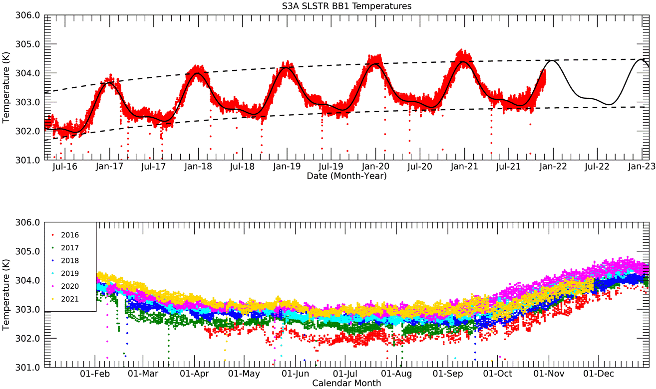
The Copernicus Sentinel-3A and B missions, launched in February 2016 and April 2018 respectively, are over halfway through their planned operational lifetimes of 7.5 years. To ensure the ongoing quality of the scientific data for climate and operational applications, it is necessary to monitor the thermal and radiometric performance to ensure that the instrument systems are maintained within their operational ranges.
Analyses of the dynamic range and noise performance of the thermal infrared channels, and of the instrument’s thermal stability, have been performed. The analysis was based on tools specifically developed to monitor the in-orbit performance of the instrument (e.g. noise, temperatures) by using data contained in the instrument’s Level-0 data stream.
The capability to generate a time series of the L1 uncertainties from the outputs of the Level-0 monitoring tools has been added, and to generate files of L1 ‘correlated’ uncertainties for each orbit, that can then be applied to the L1 images using an updated version of the pixel level uncertainty tool (MapNoiS3).
Specific outcomes of the project were:
- Addition of dynamic range trends for thermal channels S8 and S9 to the L0/1 monitoring tools.
- Addition of uncertainty trends for the thermal channels.
- Definition of a method to determine a new commanded detector offset voltage, to adjust the dynamic range of S8 and S9 following decontamination, or to account for drift of the detector response.
- An update to the MapNoiS3 uncertainty tool to include the derived uncertainties per orbit.
An additional task was to define an algorithm for processing SLSTR level-0 data containing lunar observations, to extract radiometrically and geometrically calibrated data from the lunar manoeuvre imagery. The process of generating calibrated lunar radiances from SLSTR Level-0 data for both S3A and S3B has been defined. From these radiances, the integrated observed lunar irradiances are derived and compared to lunar irradiances modelled by the GSICS implementation of the ROLO model (GIRO).