

30 January 2023
11 May 2020
The principal driver for the acquisition of such synthetic data is to enable evaluation of geostationary satellite imagery (i.e. level 1) quality and characteristics given uncertainties or variability in detector array SRFs. For example, with detector arrays, such those of the Flexible Combined Imager (FCI) planned for the Meteosat Third Generation (MTG), the degree of striping and development of methods to reduce striping may be evaluated. A secondary driver is to enable the exercising of Atmospheric Motion Vectors on synthesised IRS Level-1 products.
Objectives
HYGEOS/LOA generated two full discs with a MSG/SEVIRI spatial grid (3km at nadir) and the spectral characteristics as described in the table below.
| Low end | High end | Spectral resolution |
|---|---|---|
| Microns | Microns | |
| 0.354 | 0.884 | 1.0 nm |
| 0.884 | 1.425 | 0.5 nm |
| 1.425 | 3.200 | 1.0 nm |
| 3.200 | 3.623 | 5.0 nm |
| 3.623 | 15.500 | IASI |
Using the same spectral resolution, three more scenes (1000x1000 pixels) at higher spatial resolution (based on MODIS cloud products) were generated.
Overview
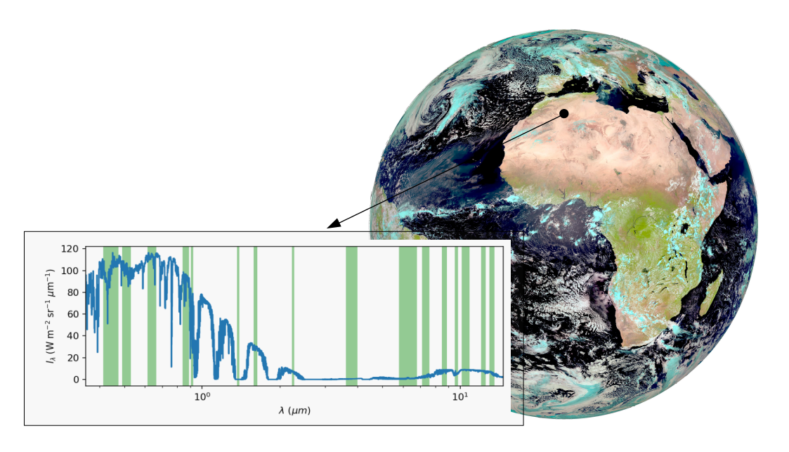
Top of the atmosphere radiances for the full range of representative atmospheric and surface conditions have been generated. The Sun and view geometries are taken from SEVIRI observations for selected repeat cycles, as is the spatial grid. For each pixel, the surface and atmosphere is realistically described based on ancillary information obtained for the dates and times of the required simulation (including OCA products for clouds coupled with ECMWF water content profile, CAMS reanalysis for aerosols profiles, ECMWF reanalysis for atmospheric state, MODIS surface BRDF product and thermal infrared climatology for land properties). For the high resolution products, MODIS or VIIRS cloud products are used.
To compute TOA radiance, the simulator uses the ARTDECO radiative transfer tool in the UV to SWIR domain and RTTOV in the thermal infrared domain. The computation is done individually (on-the-fly) for each pixel and each spectral channel (each wavelength). The scene definition (aerosol, cloud, gas and ground) is made consistent between the two spectral domains.
An extra optional Phase III was approved during the course of the project with the aim of creating a set of full 24-hour, 15-minute repeat cycle TOA radiances over the full geostationary disc computed using the spectral response function of three instruments:
- Meteosat Second Generation SEVIRI
- Meteosat Third Generation FCI
- EUMETSAT Polar System Second Generation METimage
